Located in the northern part of Bangladesh, Mymensingh District stands as a testament to the rich historical and geographical tapestry of the region. With its formation dating back to 1787 and subsequent reorganization into six districts, Mymensingh District holds a significant place in Bengal's history. Boasting a central hub, Mymensingh City, which is home to esteemed educational institutions and a population of approximately 225,811, this district's allure lies not only in its demographics and geography but also in its intriguing past as a historical frontier. As we embark on this journey through Mymensingh District, we will delve into its historical timeline, explore its major zamindaris, and uncover the notable features that have shaped its identity. Join me as we uncover the secrets and immerse ourselves in the rich heritage of Mymensingh District, a true historical frontier of Bengal.
Administrative Divisions and City
Mymensingh district, established in 1787 and later reorganized into six districts, is a historically significant administrative division in Bangladesh with a rich cultural heritage and a diverse population. One of the prominent features of Mymensingh district is the Mymensingh City Corporation, which is responsible for the governance and development of the city. The city has witnessed significant population growth in recent years, with the current population estimated to be around 225,811. This growth can be attributed to various factors, including urbanization, economic opportunities, and migration from rural areas. As a result, the city is experiencing the need for infrastructure development, improved services, and urban planning to accommodate the growing population. The Mymensingh City Corporation plays a vital role in addressing these challenges and ensuring sustainable growth for the city.
Major Zamindaris of Mymensingh (Before 1947)
Before 1947, Mymensingh district was home to several significant zamindaris, including Susanga, Muktagagacha, Ramgopalpur, Gouripur, Kalipur, and Malotipur. These zamindaris played a crucial role in the socio-economic and political landscape of Mymensingh pre-independence.
- Susanga (Maharaja) ranked 3rd in the Order of Precedence in the Government House of Calcutta before 1947.
- Muktagagacha (also called Mymensingh) was a Maharaja zamindari.
- Ramgopalpur was a Raja zamindari.
- Gouripur and Kalipur were Babu zamindaris.
- Malotipur was another zamindari in Mymensingh.
These zamindaris were known for their wealth, influence, and contribution to the local economy. They held large estates, collected rent from tenants, and had their own administrative systems. Despite their prominence, the zamindaris faced challenges during the British colonial rule and eventually lost their power and privileges after the independence of Bangladesh in 1947.
Demographics
The demographic composition of Mymensingh District reveals a diverse population with a dominant religious affiliation and a literacy rate slightly below the national average. According to the 2022 Census of Bangladesh, the district had a population of 5,899,905 and 1,460,904 households. The population density was 1,342 people per square kilometer. Islam is the dominant religion in Mymensingh District, with 96.04% of the population being Muslim. Hinduism is the second-largest religion, with 3.43% of the population. The district has experienced steady population growth, and its religious diversity adds to its cultural fabric. However, the literacy rate of 70.89% is slightly lower than the national average, indicating the need for further efforts to improve education and literacy levels in the district.
Geography
Located in northern Bangladesh, Mymensingh District boasts a unique and diverse geography that encompasses small valleys, high forests, and the sandy islands of the Old Brahmaputra River. Here are some key features of the district's geography:
- The district covers an area of 4,363.48 sq km.
- It is located at the foot of the Garo hills of Meghalaya.
- The temperature ranges from 12 to 33°C, and the annual rainfall averages 2,174mm.
- The district includes sandy islands (chars) on the bed of the Old Brahmaputra River.
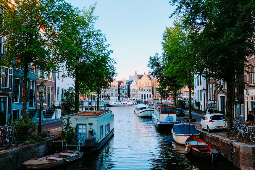
- The city of Mymensingh stands on the bank of the Old Brahmaputra, while the main flow of the Brahmaputra shifted to the Jamuna River.
With a population density of 1,342 people per sq km, the geography of Mymensingh District provides a unique backdrop for its inhabitants. The combination of valleys, forests, and the presence of the Brahmaputra River contributes to the district's natural beauty and ecological significance.
History and Timeline
Mymensingh District has a rich and complex history that spans centuries, characterized by political, social, and environmental changes that have shaped the region into what it is today. The early history of Mymensingh is relatively unknown, but it was a frontier area dividing the more populous regions of Bengal from the Garo Hills. The region was part of the kingdom of Kamarupa and later conquered by the Bengal Sultanate. Between the 14th and 18th centuries, Mymensingh was ruled by various political adventurers. The Mughal state had very little influence in the region due to its separation by the Brahmaputra River. The impact of British rule in Mymensingh is evident in its cultural heritage, as the British introduced modern administrative systems, education, and infrastructure. Significant events in Mymensingh's history include the Fakir and Sannyasi revolt, floods, famines, an earthquake, and the Swadeshi Movement. The district's timeline also includes the establishment of a branch line of the Eastern Bengal railway, which provided transportation and connectivity.
Educational Institutions in Mymensingh City
With the impact of British rule evident in its cultural heritage, Mymensingh District has developed a robust educational sector, boasting a plethora of reputable institutions in Mymensingh City. The city is known for its higher education opportunities and has become a hub for students seeking quality education. Here are four notable educational institutions in Mymensingh City:
- Bangladesh Agricultural University: Established in 1961, this renowned institution offers degrees in agriculture, veterinary medicine, and fisheries. It is considered one of the leading agricultural universities in South Asia.
- Jatiya Kabi Kazi Nazrul Islam University: Named after the national poet of Bangladesh, this university offers programs in various disciplines, including arts, social sciences, and business administration. It promotes cultural and literary activities alongside academic pursuits.
- Mymensingh Engineering College: Known for its engineering programs, this college provides students with the knowledge and skills necessary for the technological advancements of the modern world.
- Mymensingh Medical College: This esteemed medical college offers undergraduate and postgraduate programs in medicine and healthcare. It plays a vital role in producing skilled healthcare professionals for the region.
These institutions contribute significantly to the educational landscape of Mymensingh City, attracting students from all over the country and beyond. Through their emphasis on higher education and commitment to preserving cultural heritage, they shape the future leaders of the district and beyond.
Notable Features of Mymensingh District
The geographical features and historical significance of Mymensingh District contribute to its notable identity as a region with rich cultural heritage and diverse landscapes. One of the notable features of the district is the presence of several historical landmarks that showcase its cultural heritage. These include the famous Shashi Lodge, a magnificent colonial-era building that serves as a symbol of the district's architectural grandeur. Another significant landmark is the Mymensingh Museum, which houses a vast collection of artifacts and relics, offering a glimpse into the region's history. The district is also known for its picturesque landscapes, with lush green fields, serene rivers, and charming rural villages. These natural features not only add to the district's scenic beauty but also attract tourists who seek to explore and appreciate its natural splendor. Overall, the notable landmarks and cultural heritage of Mymensingh District make it a region of great historical and aesthetic significance.
Transportation and Connectivity
The transportation and connectivity of Mymensingh District play a crucial role in facilitating the movement of people, goods, and services within and outside the region. Here are some key aspects of transportation and connectivity in the district:
- Railway Network: Mymensingh District is well-connected through a branch line of the Eastern Bengal railway. This railway network provides convenient transportation options for both passengers and goods, linking the district to other parts of the country.
- River Transportation: Although Mymensingh formerly contained the mighty Brahmaputra river, the area now has very few rivers. However, the district still utilizes river transportation to some extent, especially through the Old Brahmaputra River. This mode of transportation is particularly important for connecting the district's rural areas and islands (chars) to the rest of the region.
- Road Network: Mymensingh District has a well-developed road network, connecting its urban and rural areas. This network enables the smooth movement of vehicles, allowing for easy access to markets, educational institutions, healthcare facilities, and other essential services.
- Connectivity to neighboring districts: Mymensingh District shares borders with several other districts, including Tangail, Jamalpur, Kishoreganj, Sherpur, and Netrokona. The transportation infrastructure ensures seamless connectivity between these districts, facilitating trade, commerce, and cultural exchange.
Frequently Asked Questions
What Is the Historical Significance of Mymensingh District as a Frontier Area?
Mymensingh district holds historical significance as a frontier area due to its location, which divided the populous regions of Bengal from the Garo Hills. The region witnessed various political adventurers ruling between the 14th and 18th centuries, as the Mughal state had little influence due to its separation by the Brahmaputra River. Furthermore, the district's role in the Bengal Renaissance and the impact of British colonization on Mymensingh further contribute to its historical significance as a frontier area.
How Did the Separation by the Brahmaputra Affect the Influence of the Mughal State in Mymensingh?
The separation by the Brahmaputra River had a significant impact on the influence of the Mughal state in Mymensingh. Due to this geographical barrier, the Mughal state had very little influence in the region. The Brahmaputra acted as a natural boundary, dividing Mymensingh from the more populous regions of Bengal. As a result, the region was ruled by various political adventurers, and the Mughal state struggled to establish control. This separation limited the Mughal state's presence and authority in Mymensingh throughout history.
What Were Some Significant Events in Mymensingh's History, Such as Revolts, Floods, Famines, and Earthquakes?
Some significant events in Mymensingh's history include revolts, floods, famines, and earthquakes. These events shaped the region's development and had a lasting impact on its people. Revolts, such as the Fakir and Sannyasi revolt, represented the resistance and struggle of the local population against oppressive rulers. Floods and famines brought devastation, affecting agriculture and livelihoods. Earthquakes also caused destruction, altering the landscape. These events demonstrate the challenges faced by Mymensingh and its resilience in overcoming adversity throughout its history.
What Is the Literacy Rate in Mymensingh District and How Does It Compare to the National Average?
The literacy rate in Mymensingh district is 70.89%, which is lower than the national average. Several factors contribute to this, including limited access to quality education, poverty, and cultural barriers. Efforts have been made to improve literacy rates in the district, such as the establishment of educational institutions and implementation of literacy programs. However, challenges remain, including the need for better infrastructure, teacher training, and addressing socio-economic disparities. Achieving higher literacy rates requires sustained efforts and targeted interventions.
What Are the Major Religions Practiced in Mymensingh District and What Is Their Distribution Among the Population?
The major religions practiced in Mymensingh district are Islam and Hinduism, with Islam being the dominant religion among the population. According to the 2022 Census of Bangladesh, 96.04% of the population in Mymensingh district identifies as Muslim, while 3.43% identifies as Hindu. The distribution of religions among the population is diverse and varies from area to area. This religious harmony and cultural diversity contribute to the rich tapestry of Mymensingh's social fabric.